
The first week of September 2019 hurricane Dorian left a trail of destruction from the Caribbean to the Canadian waters. It reached a category 5 strength for almost two days, and kept the title of a major hurricane from August 30th to September 3rd. According to NASA´s researchers, the hurricane had winds of over 322 km/h when it reached the Bahamas. Dorian destroyed the northern Bahamas Island, stormed the southeast U.S. coast, and hit Nova Scotia.
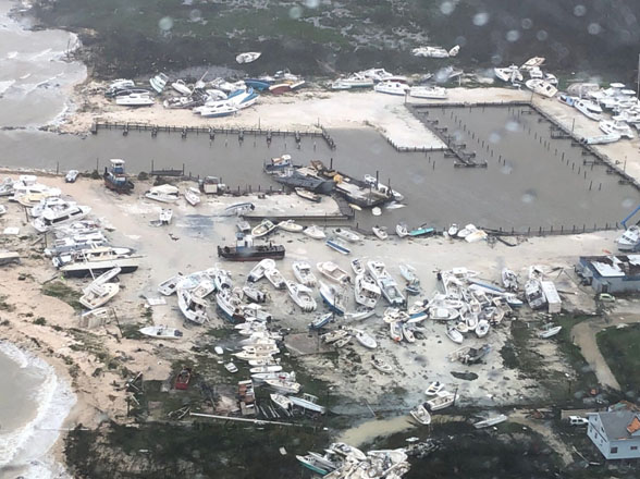
hit the island. Retrieved from: USA Today News
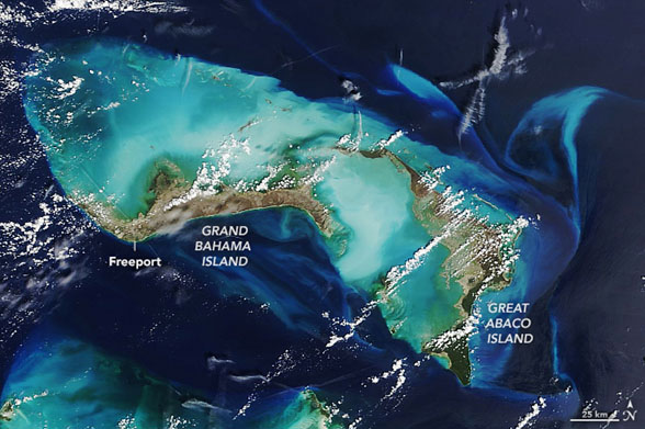
The image above shows the path of destruction Hurricane Dorian left in the Bahamas Island for nearly 40 hours. The image was taken by the Moderate Resolution Imaging Spectroradiometer (MODIS) and shows the islands natural landscape, as well as the sediments stirred up by the storm which produce a change in colour from bright green to brown.
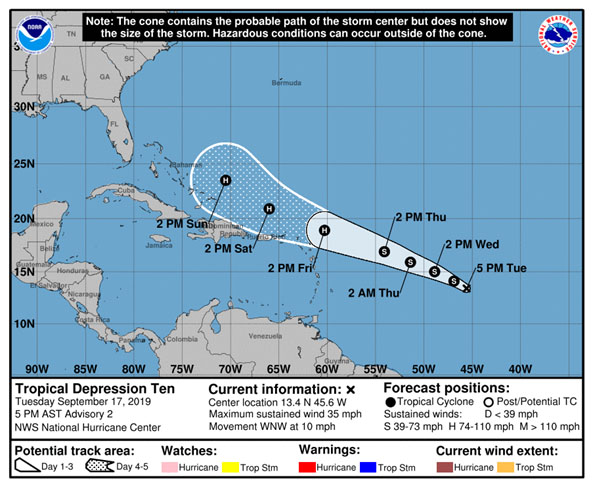
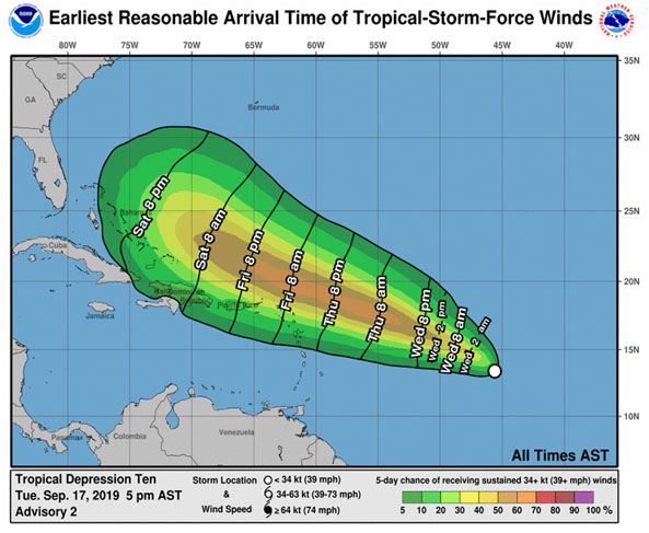
The images above are from the National Hurricane Center and the Central Pacific Hurricane Center. They display the possible path Hurricaine Dorian centre might take, and the earliest reasonable time of arrival of the storm. This information is helpful in tracing the path and estimating the trajectory, but it cannot be used to determine emergency plans since it is based on predictions and probability.
The hurricane did not only caused dangerous wind speeds but also life-threatening storm surges along the whole length of the coasts of Georgia, South Carolina and North Carolina as it left the Bahamas.
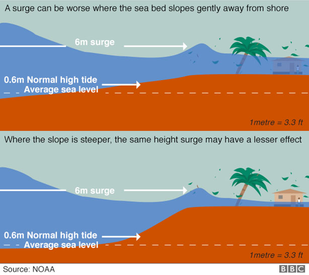
The effect of storm surges
Storm surges are produced when hurricane-force winds push huge volumes of water. When these winds meet land, the water surges inshore at levels that exceed by far normal tides. When the sea bed slope is small, the surge can be worse than if the slope is very steep. The next image illustrates this phenomenon.
Dorian is transitioning to an Extra- Tropical Cyclone according to NASA.
NASA satellites provided the National Hurricane Center with infrared data and cloud top temperature information. The importance of infrared information is that it exposes the transformation of Dorian into an extra-tropical cyclone, as it crosses the U.S. east coast.
NASA researchers use cloud temperatures to establish the position of the strongest storms within the tropical cyclone. Aqua satellite evaluated the storm applying Atmospheric Infrared Sounder or AIRS. This evaluation revealed cloud top temperatures as cold as -62.2 °C around the centre and northeast of the centre in a broad line of thunderstorms. According to NASA, these temperatures suggest strong storms with the ability to produce heavy rain.
What is an Extra-Tropical Cyclone?
Extra-tropical cyclone is a term employed to describe a cyclone that is displacing towards a pole (either North or South Pole) and therefore, is losing its tropical characteristics. This displacement generates a change in the storm’s primary source of energy from latent heat of condensation to the baroclinic process (temperature contrast between warm and cold air masses). It is important to emphasize that cyclones can become extra-tropical and also maintain winds of tropical storm force.
References:
https://blogs.nasa.gov/hurricanes/tag/dorian-2019/
https://www.nhc.noaa.gov/refresh/graphics_at5+shtml/215101.shtml?cone
https://www.nhc.noaa.gov/refresh/graphics_at5+shtml/203609.shtml?mltoa34#contents
https://www.bbc.com/news/world-latin-america-49553770
▪ ▪ ▪
Related content:
NOAA Ocean Today video: 'Hurricane Storm Surge'Storm surge is water from the ocean that is pushed toward the shore by the force of the winds swirling around the hurricane. It is the greatest threat to life during a hurricane. |